


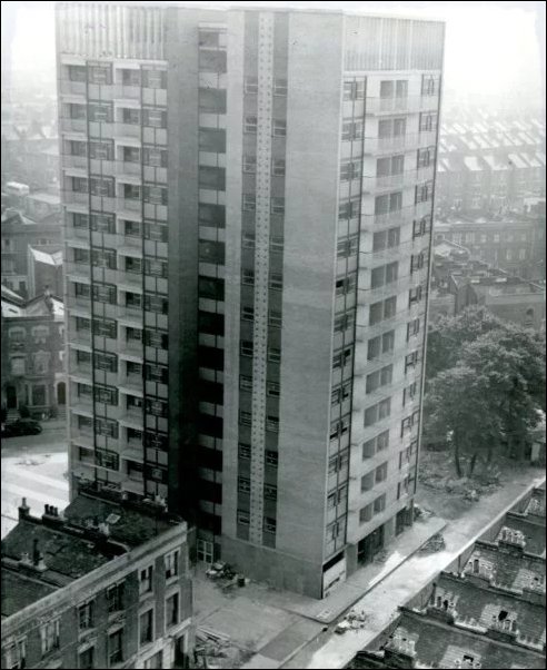
Hazelwood Tower, not long after it was built
Old Golbornes slum clearance
Dave Walker of the Royal Borough of Kensington and Chelseas Local Studies Department, based at the Hornton Street library, has another intriguing post about North Kensington's history on the excellent Library Time Machine blog.The post includes some fascinating old photos from the 1960s of a long-disappeared Golborne before sweeping slum clearance that made way for the likes of Hazelwood Tower. The photos were originally held by the councils former Health and Welfare department.
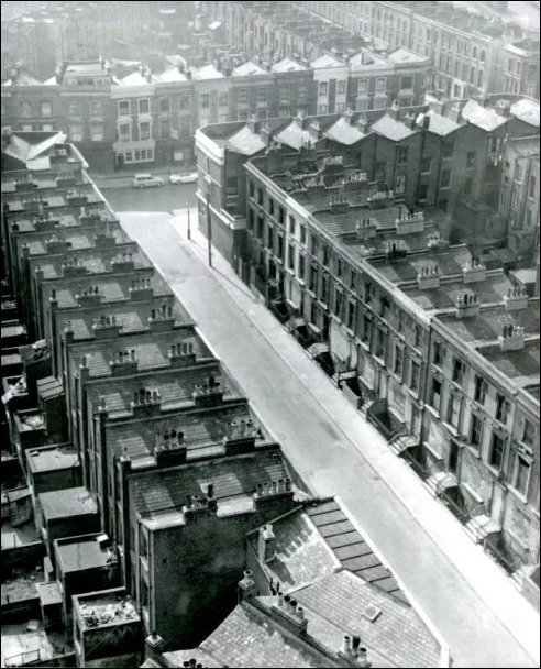
This photo shows the old Appleford Road leading to Golborne Road, before the houses were demolished and Adair Tower and Hazelwood Tower were built.
In the comments below Dave Walkers blog, Roger Rogowski writes a very helpful note:
That first photo is of Appleford Road but looking towards Golborne Road. That very distinctive shopfront facing Appleford Road, which Ive seen in two other photos, gives it away.
The street running at right angles in the top right hand corner is Southam Street running towards Westbourne Park station. From the angle, the photo was taken from Adair Tower as was the photo of Hazelwood Tower, distinguishable because its at the apex of the angle created by Hazelwood Crescent and Golborne Gardens.
Im sceptical about the date of those photos because, by 1966, Appleford Road had been demolished and the junction with Golborne Road had been blocked off by the new development of shops and flats running from the junction of Southam Street and what was the Prince Arthur (now Lowdown), which includes Kensal Town library. I think they were taken in 1962 when the towers were completed.
And Gwen Nelson, also writing in the comments, adds more fascinating detail: In the first picture it is definitely Appleford Road facing Golborne Road. The shop thats visible top left-hand is 23 Golborne Road that had the bookies downstairs and where the Gonzalez and Christou families lived upstairs.
The roof just visible to the left of that is 21 which was my fathers shop, known locally as the Green Shop because of the colour of its tiles. I used to climb up onto the roof to sunbathe as there was a nice little dip, just wide enough for a towel and a transistor radio.
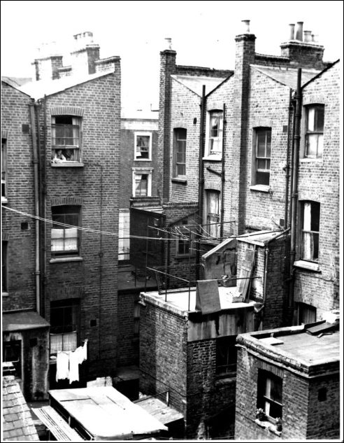
This photo shows the rear of now-demolished houses on Golborne Gardens.
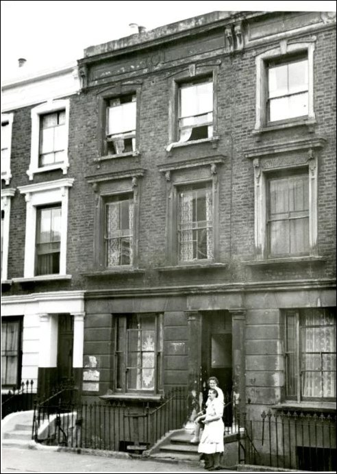
And this shot shows the frontage of the Golborne Gardens houses.
Of course, the street plan of this part of Golborne has changed beyond recognition since the 1960s. Below is a screen-grab from Google Maps of the area as it is now, including the Appleford Road and Golborne Gardens street names.

Many thanks to Dave Walker. He updates the Library Time Machine blog every week and its always full of interest. Read it here.